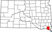
Meckling, South Dakota
Meckling, South Dakota | |
|---|---|
| Coordinates: 42°50′24″N 97°04′02″W / 42.84000°N 97.06722°W[1] | |
| Country | United States |
| State | South Dakota |
| County | Clay |
| Founded | 1873[2] |
| Area | |
• Total | 0.20 sq mi (0.53 km2) |
| • Land | 0.20 sq mi (0.53 km2) |
| • Water | 0.00 sq mi (0.00 km2) |
| Elevation | 1,155 ft (352 m) |
| Population | |
• Total | 48 |
| • Density | 235.29/sq mi (90.94/km2) |
| Time zone | UTC-6 (Central (CST)) |
| • Summer (DST) | UTC-5 (CDT) |
| ZIP code | 57044 |
| Area code | 605 |
| FIPS code | 46-41740[5] |
| GNIS feature ID | 2813012[1] |
Meckling is an unincorporated community and a census-designated place (CDP) in Clay County, South Dakota, United States. The population was 48 at the 2020 census.[6]
Meckling was laid out in 1873, and named in honor of Jones S. Meckling, a railroad employee.[7]
Due to the large number of farms that grow the crop alfalfa it has become known as the "Hay Capital of the Universe". In this fertile Missouri River valley of southeastern South Dakota, alfalfa hay is the crop of choice. Each August Meckling and its neighboring town Gayville, the Hay Capital of the World host the Annual Hay Days.
In 1965, the local school closed, and the residents were allowed to choose between the Gayville or Vermillion school districts. A couple of families, displeased with those choices, campaigned for an additional selection to be added: Wakonda.
Recently Meckling's zip code has been changed to Vermillion, SD's zip code of 57069.[8][9]
Demographics
[edit]| Census | Pop. | Note | %± |
|---|---|---|---|
| 2020 | 48 | — | |
| U.S. Decennial Census[10] | |||
Notable people
[edit]- Donna Schafer, member of the South Dakota House of Representatives from 2001 to 2006
References
[edit]- ^ a b c U.S. Geological Survey Geographic Names Information System: Meckling, South Dakota
- ^ "SD Towns" (PDF). South Dakota State Historical Society. Archived from the original (PDF) on February 10, 2010. Retrieved February 14, 2010.
- ^ "ArcGIS REST Services Directory". United States Census Bureau. Retrieved October 15, 2022.
- ^ "Census Population API". United States Census Bureau. Retrieved October 15, 2022.
- ^ "U.S. Census website". United States Census Bureau. Retrieved January 31, 2008.
- ^ "U.S. Census Bureau: Meckling CDP, South Dakota". www.census.gov. United States Census Bureau. Retrieved July 21, 2022.
- ^ Federal Writers' Project (1940). South Dakota place-names, v.1-3. University of South Dakota. p. 50.
- ^ "Meckling, SD ZIP Code Lookup | Addresses.com". www.addresses.com. Retrieved July 14, 2017.
- ^ "ZIP Code 57069 Map, Housing Stats, More for Meckling, SD". www.zipdatamaps.com. Retrieved July 14, 2017.
- ^ "Census of Population and Housing". Census.gov. Retrieved June 4, 2016.


